DESCRIPTION
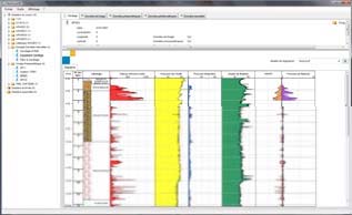
GeoVISION® is a software that enables to extract, process and format of all data coming from APAGEO data loggers. Data is inserted through a USB device, memory stick, GPRS (option) or manual input.
You can easily integrate notes, image or representative values of soil investigation.
The licence is available in 3 versions
GeoVision® - P, for Pressumeter data and edition of Pressuremeter test report
GeoVision® - F, for Drilling data
GeoVision® - D, for penetrometric data
GeoVision® - L, for Lugeon test data
APPLICATIONS
PRESSUREMETER APPLICATION
? Data importation and analysis
? Edition of pressuremeter results (including cyclic tests according to the ASTM D4719-07)
? Double hyperbolic method
? Adjustment of the pseudo-elastic phase
DRILLING APPLICATION
? Data importation and formatting
? Edition of drilling report
DYNAMIC PROBING APPLICATION
? Importation and analysis
? Edition of dynamic penetration test results
? Highlighting of compaction default and conformity statement
LUGEON APPLICATION
? Importation and calculation
? Formatting and editing report for lugeon data
GEOVISION®
THE +
Easy to use and intuitive interface
Personalized tables (diagraphy, graphs, reports)
Easy manual data input
Several work stations
Compatible with all the recent versions of Windows

 Enquiry:hkmarketing@epc.com.hk
  Whatsapp Enquiry: +85261990717


